Donated by: Carl E. Walter
Manuscript Number: MS 020
Series Arrangement:
Series 1: Exhibit
Series 2: Database
Series 3: Maps
Series 4: Print Material
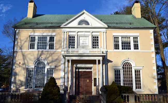
The Carl E. Walter Collection consists of various maps and research materials created by Carl from 2006 to 2024. The collection focuses on the Farmington River Canal’s location, construction and history. The canal was built in the early 1800’s as a means to transport goods. It was fifty-six miles long from New Haven, CT to West Suffield/Granby, CT and connected to the Hampshire Hampden Canal (1829 – 1847) which was thirty-one miles from Southwick, MA to Northampton, MA where it connected to the Connecticut River. The large scale model that Carl E. Walter built of the Farmington Canal Aqueduct section is on exhibit in the research room of the Simsbury Free Library.
The following finding aid may be sorted by any column header or search using the column description below the header.
To request an item from the archives please provide the collection name and the row number of the desired item in an email to simsburyfreelibrary@gmail.com with the subject ARCHIVE REQUEST.
To purchase maps from the collection, please visit our store.
| Manuscript Number | Orig Sort Row | Accession Number | Collection Title | Loc | Call # | Box (1 of #) | Folder/ Volume | Series | Description | Start Date | End Date | Notes | Archivist Notes |
|---|---|---|---|---|---|---|---|---|---|---|---|---|---|
| Manuscript Number | Orig Sort Row | Accession Number | Collection Title | Loc | Call # | Box (1 of #) | Folder/ Volume | Series | Description | Start Date | End Date | Notes | Archivist Notes |
| MS 020 | 1 | 01/01/1970 | Carl Walter Collection | LIB | Display | Exhibit | 0 | 1. Exhibit | Farmington Canal Aqueduct | 2022 | Farmington Canal Aqueduct Exhibit By Carl E. Walter 122 1/2"L x 25 1/2" W x 18 1/4" H The Farmington River Aqueduct (1826 - 1847) was 280' long x 14' wide x 6' deep and crossed the 36 feet above the Farmington River. It is represented in this 1/35 scale model which is based on a bill of timbers found in the contract with Benajah Humphrey from 1837. |
||
| MS 020 | 2 | 01/01/1970 | Carl Walter Collection | LIB | NA | SPE | 0 | 2. Database | Database: New Haven North Hampton Canal 1836 | 2023 | Carl Walter donated of his personal MAC which holds a copy of the database of his Farmington Canal presentation materials. | Housed with Maps in Library Reearch Room Credenza | |
| MS 020 | 3 | 01/01/1970 | Carl Walter Collection | ARC | 1.1.1.10 | 1 of 2 | 1 | 3. Maps | Map of the Hamshire & Hampden Canal (1829 -1847) | 2006 | Map of the Hampshire & Hampden Canal (1829 - 1847) By Carl E. Walter Folded: Map: 12" x 8" - Opened: 36" x 24" Canal map and notes by Carl E. Walter. The Hampshire and Hampden Canal was 31 miles from Southwick, MA to the Connecticut River in Northampton, MA. It connected to the Farmington Canal which ran 56 miles from New Haven harbor to West Suffield. Both canals were built to the same specifications. They were consolidated as the New Haven and Northampton Canal in 1836. The side opposite the map contains historical notes and images of historic drawings and contemporary pictures of canal remains. |
3 copies | |
| MS 020 | 4 | 01/01/1970 | Carl Walter Collection | ARC | 1.1.1.10 | 1 of 2 | 2 | 3. Maps | Map of the Farmington Canal: Hew Haven, Connecticut (1 of 9) | 2016 | Map of Farmington Canal: New Haven, Connecticut By Carl E. Walter Folded: 8 1/2" x 4 1/2" - Flat Map: 22" X 17" The New Haven section of the Farmington Canal is the first map in the series of nine maps of the Farmington Canal through Connecticut. Carl Walter based his maps on Henry Farnam's 1828 map of the canal over the US Geological Survey of 1947. It shows the canal from Long Island Sound, through the city of New Haven, and into Southern Hamden. This map includes the following engineering features: the Harbor Basin and Basin Wharf, the cut along East Creek, Hillhouse Basin, Locks 19-28, and twenty three road or farm bridges. |
2 copies | |
| MS 020 | 5 | 01/01/1970 | Carl Walter Collection | ARC | 1.1.1.10 | 1 of 2 | 2 | 3. Maps | Map of the Farmington Canal: Hamden, Connecticut (2 of 9) | 2016 | Map of Farmington Canal: Hamden, Connecticut By Carl E. Walter Folded: 8 1/2" x 4 1/2" - Flat Map: 22" X 17" The Hamden section of the Farmington Canal is the second map in the series of nine maps of the Farmington Canal through Connecticut. Carl Walter based his maps on Henry Farnam's 1828 map of the canal over the US Geological Survey of 1947. It shows the canal from central Hamden into Cheshire. This map includes the following engineering features: the stone arch culverts over Shepherd Brook, Pardee and Brook, Eaton Brook; three waste weirs; Locks 13-19, which raised or lowered the level of the canal 61 feet; the spillway at Lock 15; and twenty five road or farm bridges. |
2 copies | |
| MS 020 | 6 | 01/01/1970 | Carl Walter Collection | ARC | 1.1.1.10 | 1 of 2 | 2 | 3. Maps | Map of the Farmington Canal: Cheshire, Connecticut (3 of 9) | 2016 | Map of Farmington Canal: Cheshire, Connecticut By Carl E. Walter Folded: 8 1/2" x 4 1/2" - Flat Map: 22" X 17" The Cheshire section of the Farmington Canal is the third map in the series of nine maps of the Farmington Canal through Connecticut. Carl Walter based his maps on Henry Farnam's 1828 map of the canal over the US Geological Survey of 1947. It shows the canal from northern Hamden, through Cheshire, and into Southington. This map includes the following engineering features: Locks 13 - 10 that raised or lowered the level of the canal 32 feet; the arch culvert over the Tenmile River Valley; commercial basin Beachport in West Cheshire; to waste weirs; two tow path crossing bridges; and seventeen farm or road bridges. |
2 copies | |
| MS 020 | 7 | 01/01/1970 | Carl Walter Collection | ARC | 1.1.1.10 | 1 of 2 | 2 | 3. Maps | Map of the Farmington Canal: Southington, Connecticut ( 4 of 9) | 2016 | Map of Farmington Canal: Southington, Connecticut By Carl E. Walter Folded: 8 1/2" x 4 1/2" - Flat Map: 22" X 17" The Southington section of the Farmington Canal is the fourth map in the series of nine maps of the Farmington Canal through Connecticut. Carl Walter based his maps on Henry Farnam's 1828 map of the canal over the US Geological Survey of 1947. It shows the canal from northern Cheshire, through Southington, and into the southern part of the modern town of Plainville. This map includes the following engineering features: Locks 7 - 9 which raised or lowered the level of the canal 27 feet; three waste weirs; commecial basin Meriman's; three tow path crossing bridges; and twenty one farm or road bridges. |
2 copies | |
| MS 020 | 8 | 01/01/1970 | Carl Walter Collection | ARC | 1.1.1.10 | 1 of 2 | 2 | 3. Maps | Map of the Farmington Canal: Plainville, Connecticut (5 of 9) | 2016 | Map of Farmington Canal: Plainville, Connecticut By Carl E. Walter Folded: 8 1/2" x 4 1/2" - Flat Map: 22" X 17" The Plainville section of the Farmington Canal is the fifth map in the series of nine maps of the Farmington Canal through Connecticut. Carl Walter based his maps on Henry Farnam's 1828 map of the canal over the US Geological Survey of 1947. It shows the canal from northern Southington, through Plainville, and into southern Farmington. This map includes the following engineering features: three waste weirs; drain and source for water; three commecial basins with freight houses: Bristol Basin, Whiting's Basin, and Farmington North Basin and one without a freight house, Pitkin's Basin; one dry dock for canal boat repair; one tow path crossing; and nineteen farm or road bridges. |
2 copies | |
| MS 020 | 9 | 01/01/1970 | Carl Walter Collection | ARC | 1.1.1.10 | 1 of 2 | 2 | 3. Maps | Map of the Farmington Canal: Farmington, Connecticut (6 of 9) | 2016 | Map of Farmington Canal: Farmington, Connecticut By Carl E. Walter Folded: 8 1/2" x 4 1/2" - Flat Map: 22" X 17" The Farmington section of the Farmington Canal is the sixth map in the series of nine maps of the Farmington Canal through Connecticut. Carl Walter based his maps on Henry Farnam's 1828 map of the canal over the US Geological Survey of 1947. It shows the canal from the northern part of the of the modern town of Plainville, through Farmington, and into Southern Avon. This map includes the following engineering features: a dam and feeder canal that supplied most of the water in the canal between Granby and New Haven; a Aquaduct across the Farmington River; two stone arch culverts that crossed Poplar Swamp Brook and Thomspon's Brook, three waste weirs; one drain and source for water; two commecial basins with freight houses: Whiting's Basin and Farmington North Basin and the North Pitckin's Basin; one dry dock for canal boat repair; one tow path crossing; and twenty five foad or farm bridges. |
2 copies | |
| MS 020 | 10 | 01/01/1970 | Carl Walter Collection | ARC | 1.1.1.10 | 1 of 2 | 2 | 3. Maps | Map of the Farmington Canal: Avon, Connecticut (7 of 9) | 2016 | Map of the Farmington Canal: Avon, Connecticut By Carl E. Walter Folded: 8 1/2" x 4 1/2" - Flat Map: 22" X 17" The Avon section of the Farmington Canal is the seventh map in the series of nine maps showing the line of the Farmington Canal through Connecticut. Carl Walter based his maps on Henry Farnam's 1828 map of the canal over the US Geological Survey of 1947. It shows the canal from Northern Farmington, through Avon, and into southern Simsbury. This map includes the following engineering features: a dam and feeder canal that supplied most of the water in the canal between Granby and New Haven; an aqueduct across the Farmington River; five stone arch culverts that crossed Poplar Swamp Brook, Thompson's Brook, Woodruff Brook, Nod Brook and antoher unhamed brook; a waste weir, two commercial basins, a freight house, one tow path brossing and twenty seven road or farm bridges. | 2 copies | |
| MS 020 | 11 | 01/01/1970 | Carl Walter Collection | ARC | 1.1.1.10 | 1 of 2 | 2 | 3. Maps | Map of the Farmington Canal: Simsbury, Connecticut (8 of 9) | 2016 | Map of the Farmington Canal: Simsbury, Connecticut By Carl E. Walter Folded: 8 1/2" x 4 1/2" - Flat Map: 22" X 17" The Simsbury section of the Farmington Canal is the eight map in the series of nine maps showing the line of the Farmington Canal through Connecticut. Carl Walter based his maps on Henry Farnam's 1828 map of the canal over the US Geological Survey of 1947. It shows the canal from northern Avon, through Simsbury, into the modern town of East Granby. This map includes the following engineering features: |
2 copies | |
| MS 020 | 12 | 01/01/1970 | Carl Walter Collection | ARC | 1.1.1.10 | 1 of 2 | 2 | 3. Maps | Map of the Farmington Canal: Granby, Connecticut (9 of 9) | 2016 | Map of the Farmington Canal: Granby, Connecticut By Carl E. Walter Folded: 8 1/2" x 4 1/2" - Flat Map: 22" X 17" The Granby section of the Farmington Canal is the ninth map in the series of nine maps showing the line of the Farmington Canal through Connecticut. Carl Walter based his maps on Henry Farnam's 1828 map of the canal over the US Geological Survey of 1947. It shows the canal from northern Simsbury throug the modern towns of East Granby, Granby, Suffield, to the Massachusetts state line. |
2 copies | |
| MS 020 | 13 | 01/01/1970 | Carl Walter Collection | LIB | Display | NA | 0 | 3. Maps | Farmington Canal - Set of 9 Laminted Flat Maps | 2016 | A complete set of the nine flat Farmington Canal maps by Carl E. Walter, laminated for display, for: New Haven, Hamden, Cheshire, Southington, Plainville, Farmington, Avon, Simsbury and Granby. | 1 set | |
| MS 020 | 14 | 01/01/1970 | Carl Walter Collection | ARC | 1.1.1.10 | 1 of 2 | 3 | 4. Print Material | Farmington Canal Aqueduct: Created by Carl Walter | 2022 | Walter, Carl, Sarah Hart and the Simsbury Free Library. Farmington Canal Aqueduct: Created by Carl E. Walter, June 2017 - September 2022. Simsbury CT: Simsbury Free Library, 2022. A history, in progress report notes and pictures, of how Carl E.Walter created and launched the Farmington Canal Aqueduct Exhibit housed in the Simsbury Free Library. Call Number: 388/Canal/Walter. |
One copy in stacks (On Display) and one in Archives. | |
| MS 020 | 15 | 01/01/1970 | Carl Walter Collection | LIB | Display | Display | 0 | 4. Print Material | Historic Prints and Photos of the Farmington Canal | 2024 | Set of 16 - 8" x 10" images of paintings, drawings, or photographs of the Farmington Canal throughout its history in a 3-ring binder which was assembled by Carl Walter. | On Display |
Language: English
The collection is open for research.
The collection is in good condition.
Simsbury Free Library’s Quarterly Newsletter Cross-Reference:
Library News: “In Appreciation,”
Library News: “Award of Merit for Carl E. Walter,” Simsbury Genealogical and Historical Research Library, Vol. 22, Issue 4, (Winter 2016-2017), p.12
Library News: “A Party for Members in the Fall,” Simsbury Genealogical and Historical Research Library, Vol. 24, Issue 1, (Summer 2022), p.8
| Copyright has been transferred to the Simsbury Free Library for materials authored or otherwise produced by the creator(s) of this collection. Copyright status for other collection materials is unknown. Transmission or reproduction of materials protected by U.S. Copyright Law (Title 17, U.S. C) beyond that allowed by fair use requires the written permission of the copyright owners. Works in the public domain cannot be commercially exploited without permission of the copyright owners. Responsibility for any use rests exclusively with the user. Transmission or reproduction of materials protected by U.S. Copyright Law (Title 17, U.S.C) beyond that allowed by fair use requires the written permission of the copyright owners. Responsibility for any use rests exclusively with the user. |
Web Finding Aid: Sarah Neagoy 2025.